Via Algarviana & Ecovia do Litoral

Algarve

Algarve

Ecovia do Litoral, also known as Eurovelo 1, leads all along the coast. While traversing this picturesque route, be prepared crowded, tourist-centric areas, a stark contrast to the natural beauty of other Portuguese coastal regions.

In Sagres and Lagos we find two towns full of history and coastal allure, cobbled streets and the marvel Ponta da Piedade’s rock formations.

Pedaling towards Portimão and Albufeira uncovers vibrant promenades, beachside cafes, and bustling nightlife. Navigate the Old Town’s narrow streets and experience the lively Fisherman’s Beach ambiance, bustling with vibrant bars and restaurants.

Vilamoura’s opulent marina showcases upscale leisure, boasting luxury yachts, waterfront dining, and chic boutiques. Nearby Falesia Beach offers tranquility amid the often bustling crowd.

Faro, the capital of Algarve, features a historic center within ancient walls amidst tourist excitement. Enjoy panoramic views from Faro’s Marina and explore the diverse wildlife and landscapes of Ria Formosa Natural Park.

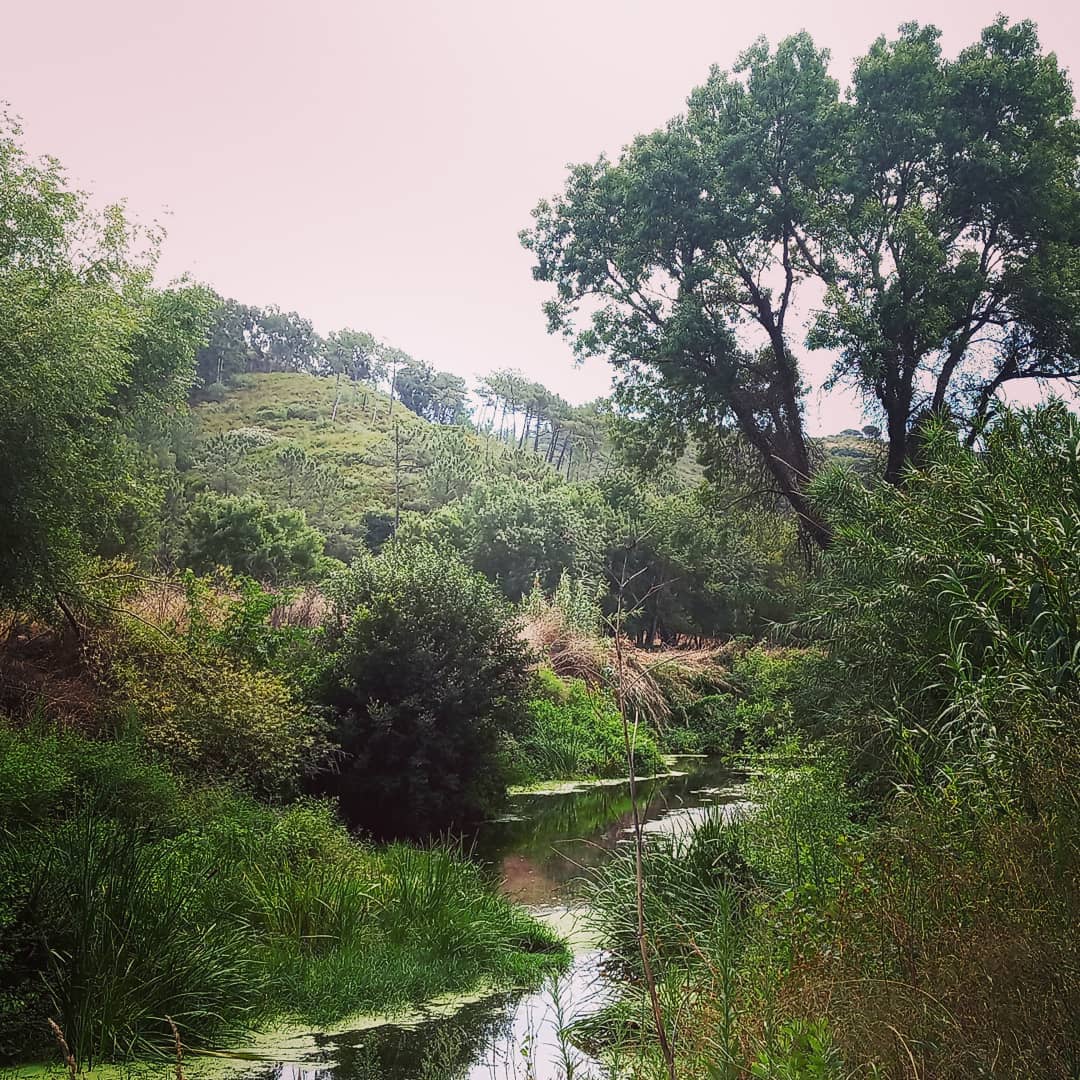
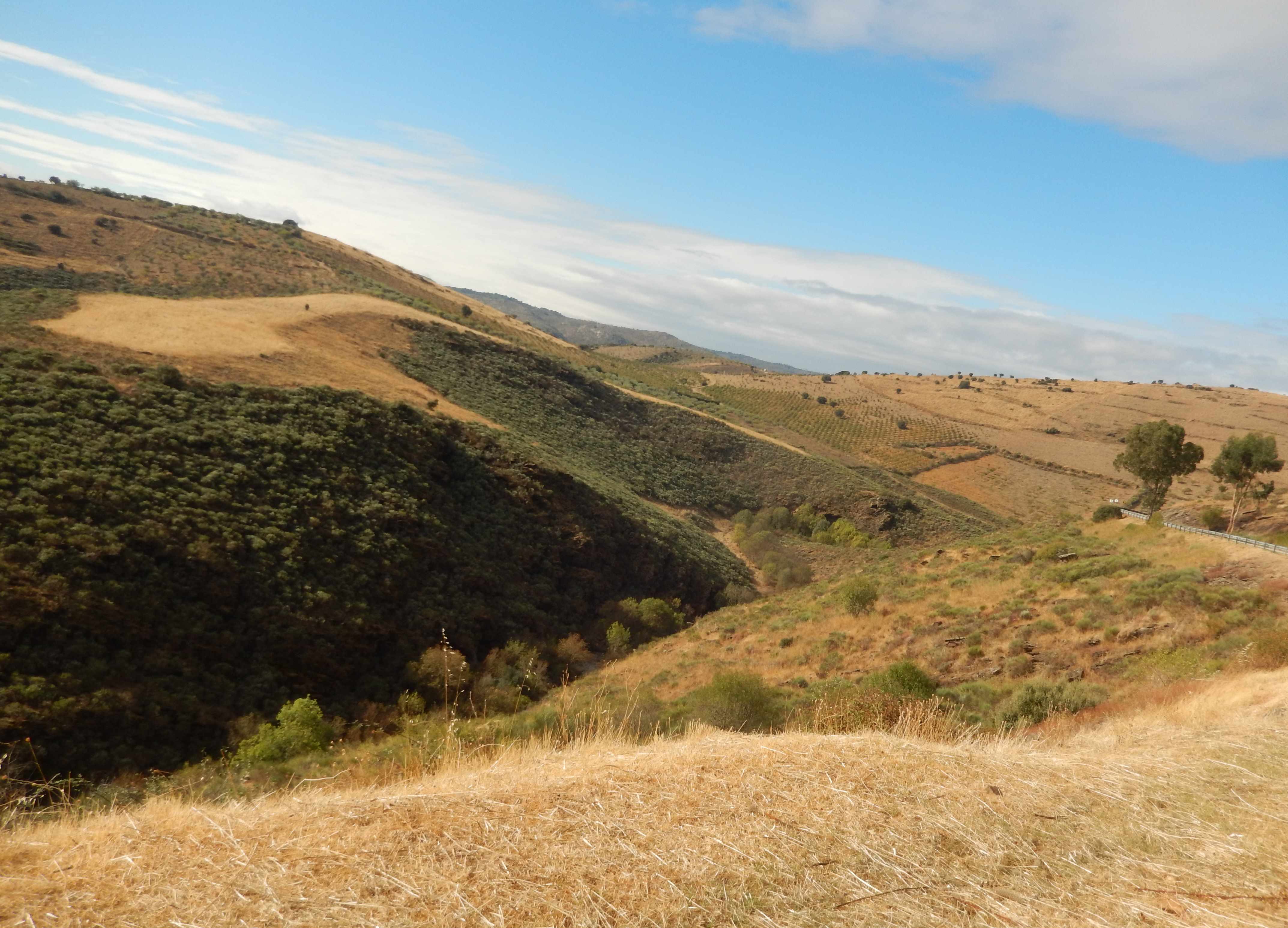
As soon as you leave the coast behind the Algarve shows a different face. Even many comunal and provincial roads are unpaived and turn the Algarve into a MTB touring paradise. Rural, laidback lifestyle with sparsy population, wide cork forests, traditional orange and olive plantations, free running porks, goats and chickens represent what people have in mind when thinking of the Algarve.

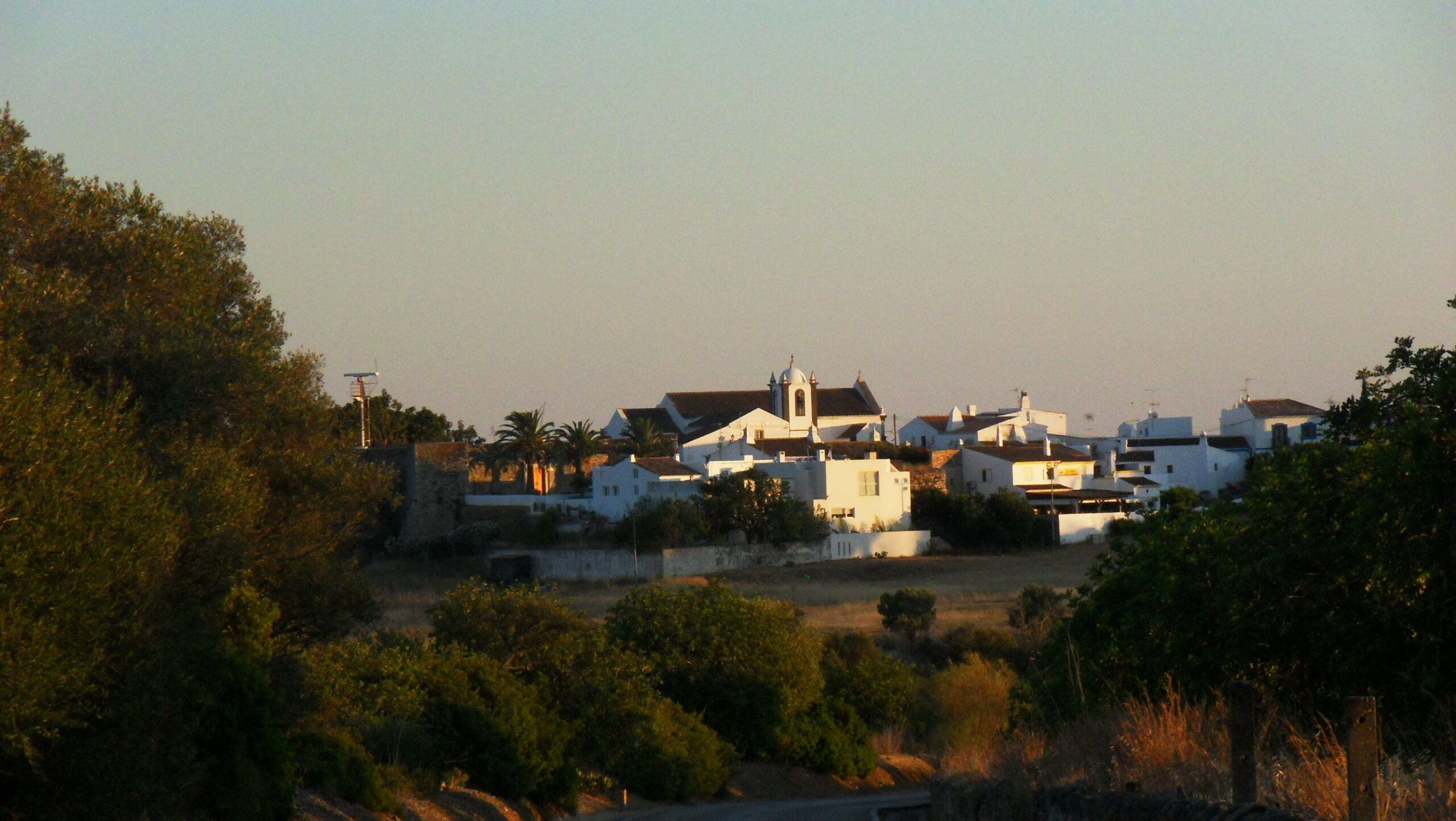
Some cultural herritage compansate for the tough uphills and rough terrain. The ancient cork plantations forests and local traditions of Serra de Monchique or the castle town Silves or the Market in Loule are true highlights along the route and offer much more of an authentic Portuguese experience than the coast.

Via Algarviana is originally a hiking track. Rarely the routes leads more than 500m in a row on asphalt. With more than 8.000m elevation gain on only 300km this might be the most challenging long distance bike route in southern Portugal.

Riding from West to East comes with longer and steeper uphills, but most technical sections, a few singletrails and bumpy trails, are mostly downhill sections. The Western part is dominated by the tough uphill to the mountain Foia (1000m), while the eastern part is dominated by a permanent up and down. Especially around Serra de Monchique, where the route climbs up to 1.000m, it is a quite rough terrain. We recommend to follow an alternative route between the water resort Barragem de Odelouca and Monchique.

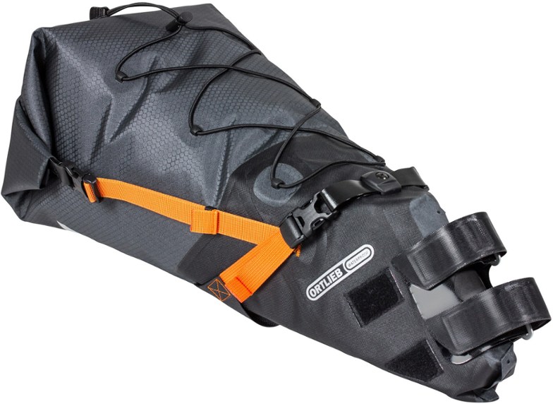
Do not underestimate how remote this route is. The route is pretty well indicated and relatively easy to find, nevertheless we recommend to have a GPS track with you. Often we will only find snack bars and grochery stores in the main villages. Make sure to carry enough water and some snacks with you during the ride.

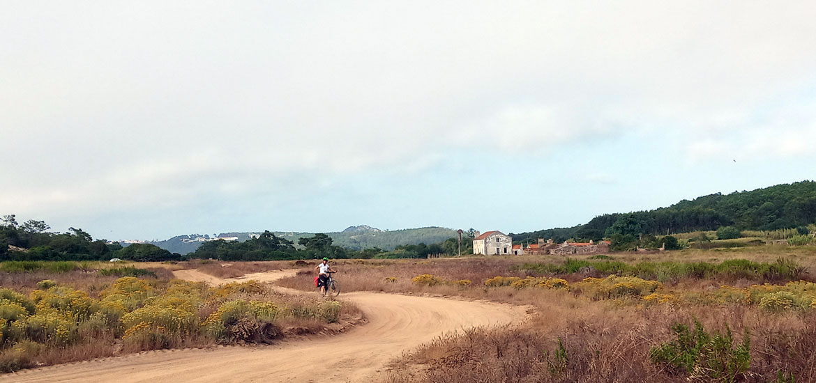
The Ecovia do Litoral is a relatively easy route along the coast from Sagres to the Spanish border. The Algarve coast is quite urban. The terrain consists of roads, cycling lanes, and unpaved paths. It has clear and easy-to-follow indications, making it relatively easy to cycle.

Via Algarviana leads you through the interior and was originally a hiking track. Especially around Serra de Monchique, where the route climbs up to 1,000m, it can be a challenging tour. This path is characterized by numerous steep uphills and sparse population, providing a more rugged and demanding cycling experience. Not everywhere along this route, you will find grocery stores or amenities to purchase water, so it’s advisable to carry sufficient supplies.

Ecovia do Litoral is good on all bikes, Via Algarviana requires MTBs

For the Via Algarviana, gravel bikes are a good choice. The route primarily consists of paved surfaces and solid dirt roads. With a bit of cycling experience, nothing along this route should pose too much of a challenge.

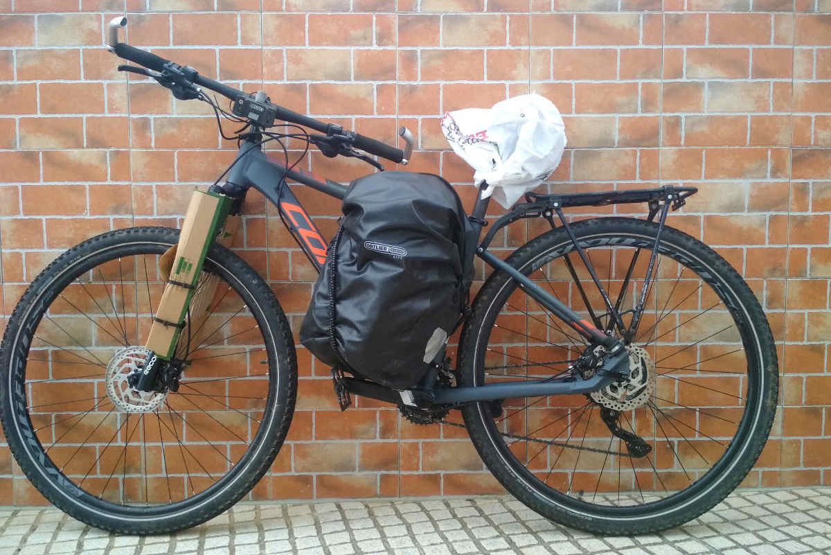
The route through the interior, however, is more suited for mountain bikes. In certain sections, even full suspension bikes might be necessary if you wish to stay as close as possible to the original track. Yet, with some route planning, there are excellent gravel paths to be discovered in the Algarve’s backlands. It’s important to note that this route is quite challenging. During the summer months, we recently completed this tour on e-bikes, which made it an enjoyable challenge despite the heat.


Rental Bikes

     
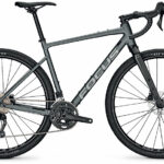
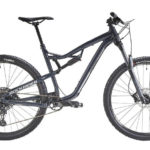
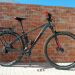
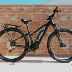
    Gravel Bikes              Full Suspension           Travel MTB
     
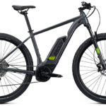
Travel E-MTB Men    Travel E-MTB Woman

Log-In Area

Alcoutim - Vaqueiros

The impressive Via Algarviana commences near Alcoutim Pier, an homage to the region’s smuggling history by the picturesque Guadiana River. Traversing the town and aligning briefly with PR3 ACT – The Charms of Alcoutim Path, it proceeds along the riverbanks, showcasing active rural orchards. Diverging westward to Cortes Pereiras, it ventures through old drystone wall-bordered paths, leading past Lavajo Menhirs and rural hamlets like Afonso Vicente and Corte Tabelião. The journey advances southeastward, crossing roads, gullies, and streams until Torneiro, merging momentarily with PR2 ACT – Ladeiras do Pontal, culminating in Balurcos.

Amidst this stretch lies the “Guadiana” Site, sheltering endangered fauna like Spanish minnowcarp and avian species such as Bonelli’s eagle and Eurasian golden oriole. Notable mammals, including otters and various bats, inhabit this zone.

The next leg, originating from Balurcos, navigates southward through country paths, unveiling the Foupana Stream, rural architecture, and abandoned landmarks like windmills. Traversing holm oak forests and ascents, it reaches Corte Velha, showcasing remnants of cereal farming and grazing. Climbing to a water tank, it offers scenic views before concluding at Furnazinhas, a cultural hub retaining rural traditions and serving as the sector’s endpoint.

Streams like Foupana and Odeleite thrive here, adorned with ash, willow, and oleander trees. The sector houses diverse mammals like cape hares, European rabbits, and elusive wild boars and foxes. Avian enthusiasts can spot species like Bonelli’s eagle, Dartford warblers, and short-toed snake eagles.

Beginning at Furnazinhas, the third leg heads north, encountering rugged landscapes, small settlements, and maritime pines. Passing uninhabited hamlets like Monte Novo and Monte das Preguiças, it proceeds to Vaqueiros, revealing Roman archaeological remnants and traditional rural life. Holm and cork oak groves adorn this zone, alongside watercourses teeming with lush vegetation.

Birdwatchers can delight in spotting numerous species, including Dartford warblers and buzzards, amid the rich natural tapestry. The sector culminates near Vaqueiros Dam, framing the village against its backdrop. Vaqueiros stands as the most populated village, resonating with Moorish history and a multitude of settlements, adorned with Roman archaeological remnants and vegetable gardens sustaining its inhabitants year-round.

Lisbon - Lagos

Vaqueiro - Salir

The Via Algarviana’s second segment unveils the heart of the Mú Hills, offering challenging terrains amid breathtaking vistas. The winding path traverses rugged landscapes, presenting uphill panoramas and downhill escapes through green valleys and streams.

Beginning from Vaqueiros, the route meanders southwestward past stone-walled vegetable gardens and rockrose-laden landscapes. Monchique, Amoreira, and Casas Baixas grace this journey, showcasing rural traditions and friendly settlements, intersecting with footpaths like PR1 TAV – D. Quixote Path and PR3 TAV – Montes Serranos Path.

Settlements along the route boast family gardens and preserved architectural gems, inviting interactions with amiable locals. Moving towards Cachopo, a serene cork oak forest prevails, framing the village’s traditional essence, culminating at the Church of Santo Estêvão.

Embarking on the following leg from Cachopo, the route navigates through Currais and Alcaria Alta, providing vistas of uplands and traditional produce. Crossing Odeleite Stream, it ascends to Parises, a pivotal point linking to Connection 1 – Via Algarviana to São Brás de Alportel, known for its traditional charm.

Continuing westward, the trail traverses gorges, reaching Cerro da Relva with panoramic views. Veering through the Vale Formoso Stream and PR5 LLE – Montes Novos Walking Path, it intersects with Connection 6 – Ameixial to the Via Algarviana at Barranco do Velho. This hamlet showcases cork oak landscapes, a testament to cork’s significance in the region’s economy.

Intersection with PR17 LLE – Barranco do Velho Walking Path at Barranco do Velho leads through shaded paths abundant in cork oaks. The hamlet invites exploration, offering local produce and glimpses into cork-related industries.

Subsequently, the trail diverges to the right, leading past Faranhão Windmill and offering panoramic viewpoints. The route descends into Carrascalinho, revealing ravines and dense Mediterranean scrubland. The Rio Seco Stream serves as a serene spot for relaxation before transitioning into a barrocal landscape, characterized by dryland farmlands and orchards leading to Salir.

Salir, a hub rich in historical and cultural heritage, straddles the Alentejo-Algarve border, resonating with ancient Celtic and Moorish legends. This sector, abundant in orchids during spring, offers a mystic allure, inviting exploration and storytelling entrenched in local folklore.

Algarve & Alentejo by Bike

Silves - Monchique

The journey on the Via Algarviana starts from the historic city of Silves, nestled by the River Arade. The route commences amid the picturesque settings by the Moorish castle and the old Cathedral, both crafted from the renowned Silves sandstone. Moving through the Monchique Hills, the landscape transitions from citrus groves to the dramatic relief dominated by extensive rockrose bushes and pine groves. As you venture deeper, embracing the hills, panoramic views unfold, offering a sensory delight amid diverse flora like French lavender and thyme.

The trail traces through ancient farming villages, Carapinha and Romano, now in ruins, preceding the approach to the Odelouca Stream. Here, nestled along the tributaries, small villages like Zebro, Barreiro, Touril, and Foz do Barreiro thrive with subsistence farming and scenic landscapes. The trail meanders alongside the Monchique Stream, its riparian beauty marking an uphill journey toward Fonte Santa and the ancient thermal complex, now owned by the Municipality of Monchique.

Continuing the ascent, eucalyptus-lined pathways offer stunning views of the mountains and the coast, guiding travelers past Fornalha, Corte Grande, and Portela de Monchique before reaching Picota, the second-highest point in the Algarve. The breathtaking scenery here, with views extending to the Alentejo on clear days, resonates with an almost ethereal charm. Heading towards Monchique, a dense grove of majestic cork trees envelops the path, creating a fairy tale-like ambiance.

Monchique’s presence in the Natura 2000 Network speaks of its ecological significance. Picota Hill, standing at 774 meters, offers unparalleled vistas, showcasing the native vegetation of the Monchique Hills. The landscape comprises diverse forestland, hosting rare and endemic plants alongside monumental trees like Norfolk Island pines, plane trees, and Algerian oaks.

Continuing from the Tourist Information Office, a 3km uphill journey commences, leading through Monchique’s charming streets before delving into a dense eucalyptus grove. Crossing the municipal road, the route winds through mountainous landscapes and vegetation, revealing the stunning vistas from Fóia, the highest point in the Algarve at 902 meters.

Descending through terraced farmlands, villages like Vale da Moita, Barbelote, and Porta da Horta punctuate the trail, leading to Madrinha and a wind farm. The path traverses eucalyptus forests, eventually crossing the national road 1087 towards Picos, offering captivating views. The landscape transforms into cork oak forests, leading to Marmelete, known for silviculture, cork cultivation, pig farming, and the production of local delights like “medronho” brandy.

This sector of the Via Algarviana unfolds diverse terrains, historical landmarks, and rich biodiversity, providing an immersive journey through the captivating landscapes and cultural heritage of the Algarve.

Porto Covo by Bike

Marmalete - Cabo Sao Vicente

This section of the Great Route starts from the center of Bensafrim heading southwest towards Barão de São João. This is the most rural part of Lagos municipality, where agriculture, especially organic farming, is prevalent. After passing the Parish Council office, our path intersects with Link 4 – Lagos Train Station to Via Algarviana (Bensafrim) for about 300 meters. Then, this Link turns left, while our section continues ahead, still on a stretch of paved road.

The initial phase of this stage traverses a typical landscape of the “barrocal,” featuring dense Mediterranean scrubland with plenty of holm oaks, arbutus, rosemary, lavender, and other shrubs. We’ll pass through a large and beautiful cork oak forest, providing cool, dappled shade.

The terrain is gently undulating, and we soon arrive at Barão de São João, where you can replenish supplies at the grocery store and snack bar. There’s also interesting heritage to explore, particularly the parish church. Over the years, Barão de São João has attracted a diverse community of people from various countries, including many artists who have chosen to reside here. Take a stroll through the village and discover the sculptures and paintings that adorn the area.

After crossing the village, the Via Algarviana heads northwest into the Barão de São João Forest Perimeter. This pine forest is possibly the largest in the region, serving as a refuge for wildlife and a leisure space for visitors to rest and picnic. Here, you’ll encounter one of the 12 complementary walking trails to Via Algarviana, the PR1 LGS – Pedestrian Route “Pedra do Galo”.

The typical mountainous landscape resumes along the route, with hills and valleys intersecting continuously. Highlights include the Vinha Velha valley, a fertile agricultural area connected to agrotourism, and the Monte de São Lourenço, near the Pardieiro geodesic marker, one of the highest points in this area (144 meters).

As we approach the Sesmarias site, the landscape changes once more, now surrounded by extensive agricultural plateaus. Passing by Budens Lagoon, a small wetland area hosting various species of waterfowl and amphibians, springtime heralds the croaking of frogs in this location.

This sector is close to the former “granary of the Algarve” and the Costa Vicentina, marked by limestone outcrops, scattered vegetation, extensive pastures, and agricultural fields. It’s in this area that we catch the first glimpse of the sea! South of EN 125, we enter the Southwest Alentejo and Vicentine Coast Natural Park, one of the most beautiful protected areas in the country, ultimately arriving at Vila do Bispo.

Close to Raposeira, we intersect with another complementary pedestrian route to Via Algarviana, the PR4 VBP – Pedestrian Route “Pelas Encostas da Raposeira”. In Raposeira, take a break at the cafés or snack bar. The journey concludes in Vila do Bispo, the starting point for the last day of this adventure through the lesser-known Algarve.

The Barão de São João Forest Perimeter, spanning 207.7 hectares, is part of the Natura 2000 Network – Southwest Coast, dominated by stone pine (179 ha) and acacia (38 ha), with small patches of Portuguese cypress, eucalyptus, and Monterey cypress.

In this section, walkers can admire a diverse landscape, from agricultural fields, orchards, cork oak and pine groves to coastal scrubland, wetlands, limestone cliffs, and beaches.

Travel Bikes – MTB – E-Bikes – Gravel

Rental Bikes

Travel MTB

Travel E-MTB (M/W)

Fully MTB

Gravel Bikes

Luggage Transfer

We deliver your luggage daily from hotel to hotel or bring it directly to your your final destination

One Way Rentals

Pick up your bike in Lisbon, Ericeira or Porto and drop it off at one of our drop off partners all over Portugal

Bike Packing

Panniers, handlebar bags, sleeping bags, lights, GPS Systems and more

Bike Packing

Panniers, handlebar bags, sleeping bags, lights, GPS Systems and more

Bike Packing

Panniers, handlebar bags, sleeping bags, lights, GPS Systems and more

Bike Packing

Panniers, handlebar bags, sleeping bags, lights, GPS Systems and more